Texas General Land Office
History and Archives > Search Land Grants. (primary documents)
Categories of Land Grants
General Land Office
Texas Land and Property
Information about land grants from Spain, Mexico, The Republic and State of Texas
Ellis County Appraisal District Interactive Map
Search for property boundaries, owners, land grant abstract numbers
Texas Land Measurements
Measurements pertinent to understanding surveys, deeds, abstracts
Ellis County Appraisal District Search
Map location, owner name and address, market value
Balcones Fault Zone Map
Shows faults along line from Del Rio, San Antonio, Austin, and Dallas. 1990.
1840 Texas Map by Gen. Stephen F. Austin
Ellis County is part of Robertson County south of the Trinity River (Rio Trinidad)
1840-41 Old Military Road Map by Col. William G. Cooke
Shows his route through what would become Ellis County
1855 Texas Map
The Portals to Texas History. Zoom in to Ellis County which shows only Waxahachie and Navarro town and the common road that connects them.
1857 Ellis County Map
The Portals to Texas History. Zoom in to search land grants from Republic of Texas and Mexico
1879 Ellis County Map
Library of Congress from TX General Land Office. Zoom in to search land grants from Republic of Texas and Mexico
1889 Ellis County Map
Library of Congress from TX General Land Office. Zoom in to search land grants from Republic of Texas and Mexico
1906-07 Ellis County Map
Interactive map searchable in 13 sections
1959 Ellis County Map
Texas Highway Department - general highway map with legend
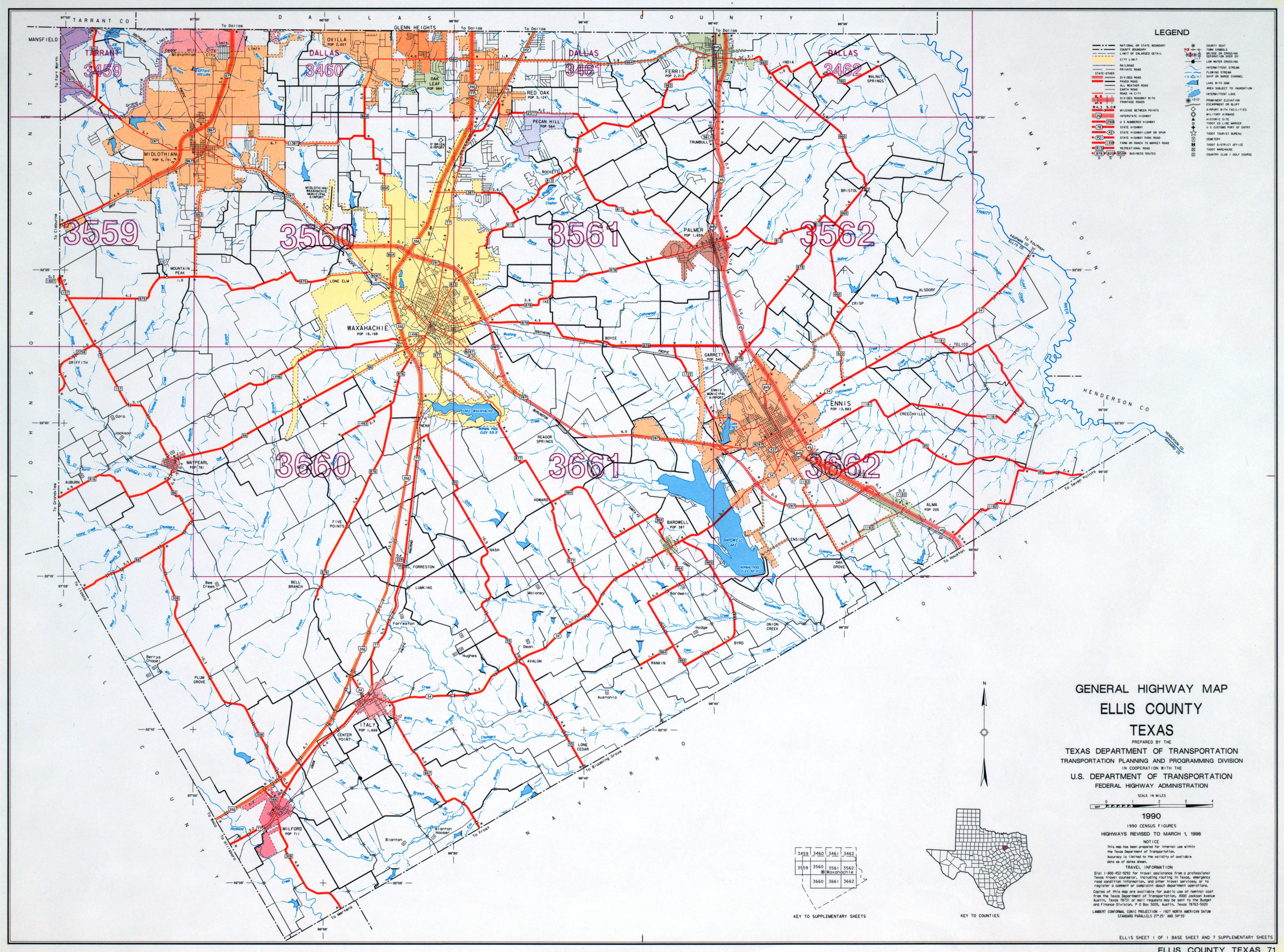
1990 Ellis County Map
General highway map. Click to zoom in and out
2015 Ellis County Map
Official county map
Sanborn Fire Insurance Maps
Perry-Castaneda Library Map Collection, UT Austin
Historic Texas Maps
List from Hidden Ancestors - 1800s
Archives Locator
Find archive repositories and search their collections
